Manuel B. Gonnet (Manuel B. Gonnet)
Manuel B. Gonnet is a city in La Plata Partido, Argentina. It is part of a group of neighborhoods developed around the then Buenos Aires Great Southern Railway (later Ferrocarril General Roca) connecting La Plata with Buenos Aires, and Tolosa, Ringuelet, City Bell and Villa Elisa.
It is named after Manuel Bernardo Gonnet, first provincial minister of Public Works (after the Federalization of Buenos Aires) and provincial legislator.
According to the 2001 Census INDEC, Manuel B. Gonnet has a population of 22,963 in 2.335 ha.
On 13 July 1882 the provincial government started construction of new railroad branches to connect the new provincial capital with the Buenos Aires Western Railway and the Buenos Aires Great Southern Railway. The La Plata - Empalme Pereyra (Villa Elisa) line was opened on 1 January 1889.
In 1889 at the inauguration of the Adolfo Alsina train station, the local landowners decided to start a partnership, subdivide part of the land into lots and found a town. The train station opened on 15 February and on 24 February they announced the establishment of Villa Máximo Paz, named after the then governor. However, the enterprise did not immediately succeed and it took many years to attain a stable population. Initially, the first houses were used as weekend retreats for the rich people of La Plata.
When the population started to become established in 1909, Luis Castells, owner of the land on the north side of the railway decided to fraction and sell his land and started the town of Villa Castells.
In 1931 the city was renamed as Manuel B. Gonnet, joining Villa Máximo Paz and Villa Castells.
In this area, a theme park, the Republic of the Children, of around 53 ha was built in 1951 inspired by the tales and characters of the Brothers Grimm.
Map - Manuel B. Gonnet (Manuel B. Gonnet)
Map
Country - Argentina
 |
 |
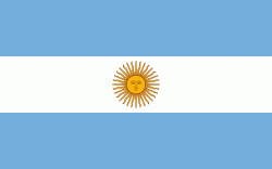
| Flag of Argentina | |
The earliest recorded human presence in modern-day Argentina dates back to the Paleolithic period. The Inca Empire expanded to the northwest of the country in Pre-Columbian times. The country has its roots in Spanish colonization of the region during the 16th century. Argentina rose as the successor state of the Viceroyalty of the Río de la Plata, a Spanish overseas viceroyalty founded in 1776. The declaration and fight for independence (1810–1818) was followed by an extended civil war that lasted until 1861, culminating in the country's reorganization as a federation. The country thereafter enjoyed relative peace and stability, with several waves of European immigration, mainly Italians and Spaniards, radically reshaping its cultural and demographic outlook; over 60% of the population has full or partial Italian ancestry, and Argentine culture has significant connections to Italian culture.
Currency / Language
| ISO | Currency | Symbol | Significant figures |
|---|---|---|---|
| ARS | Argentine peso | $ | 2 |
| ISO | Language |
|---|---|
| EN | English language |
| FR | French language |
| DE | German language |
| GN | Guarani language |
| IT | Italian language |
| ES | Spanish language |


